
Background
Municipalities in Mexico (or, municipios in Spanish) form the intersection point between political geography and Census geography. Municipios are civic boundaries, in the sense that each municipio hosts a popularly elected local government, headed by a 'presidente'. Municipio governments provide public services and serve as a recorder of public data, such as traffic fatalities or educational enrollment. For many businesses, demographics at the municipio level offer great comparative insight into their markets. We'll guide you through the municipality structure of Mexico, and how your business can use municipio data as part of your research process.
Municipio structure
Despite some differences, a municipality is a lot like a U.S. county. For one thing, they have total territorial coverage: every square foot of land in Mexico falls within the jurisdiction of a municipality. For another thing, municipalities are uniquely related to states: they don’t cross state lines. They sometimes (but not always) completely contain metropolitan areas. Municipalities are similar in size and population to U.S. counties.
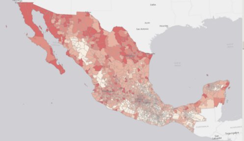
Similar to counties, the size and population of municipalities is not written in stone. A lot of factors, from the history of colonization to the timing of population growth on the frontiers, affect the size, shape and population of a municipality. There’s great diversity among Mexican municipios. There are large ones (averaging 5,700 square miles in Baja California Sur), and there are small ones (averaging just 25 square miles in Tlaxcala). There are states with many (Oaxaca, with 570) and states with few (the Baja Californias, with 5 apiece).
This last point is an important one. Business users who analyze a location based on the demographics of its municipality can run the risk of not comparing apples-to-apples. In Oaxaca, a municipality may be not much larger than a village. Why compare those demographics to, for example, municipalities from the Distrito Federal, one of the densest populated areas in the world?
As of writing, there are 2,457 municipios in Mexico. That number is subject to change, based on a periodic realignment of political boundaries. The newest Municipio, called Bacalar in the state of Quintana Roo, is just a couple of years old.
Municipios and Mexican demographic data
Using a municipio as a unit of geography for business research in Mexico makes sense for a lot of organizations. Retailers and CPG companies who are strategizing a market entry would be ideal candidates; a demographic dataset at this level would help them determine which areas of the country are best suited for the “first wave”. For other organizations, it makes sense. Businesses with an extensive footprint in Mexico, who are pursuing fill-in growth and making rooftop-level decisions, would be better served by demographics at an AGEB or Manzana level.
But, even for power users, there’s a compelling case for why municipios should be part of your research process. It revolves around the scale and scope of data available at this geographic level. Things like vehicle registration, mortality statistics, agricultural production figures, and many other niche datasets are only compiled down to the municipio level. The best part is that, more often than not, these data are tabulated annually, meaning you have a fresh dataset off of which to base important decisions.
Wrap-up
Overall, a municipio is a great geographic unit for business analysis, with some tradeoffs. Municipios aren’t the best for trade area delineation or sales forecasting, but they are a great way to get a handle on macro-market analytics. We develop extensive demographics datasets at the municipio level, and we offer custom datasets that bring in some of the more obscure variables. There’s a lot of value to be had for Mexico researchers with municipality data. Keep exploring geoanalitica.com to learn more about what can be done.